
空港・新幹線駅までの到達時間マップ / Travel times to the nearest airports and Shinkansen stations in Japan
2025年11月
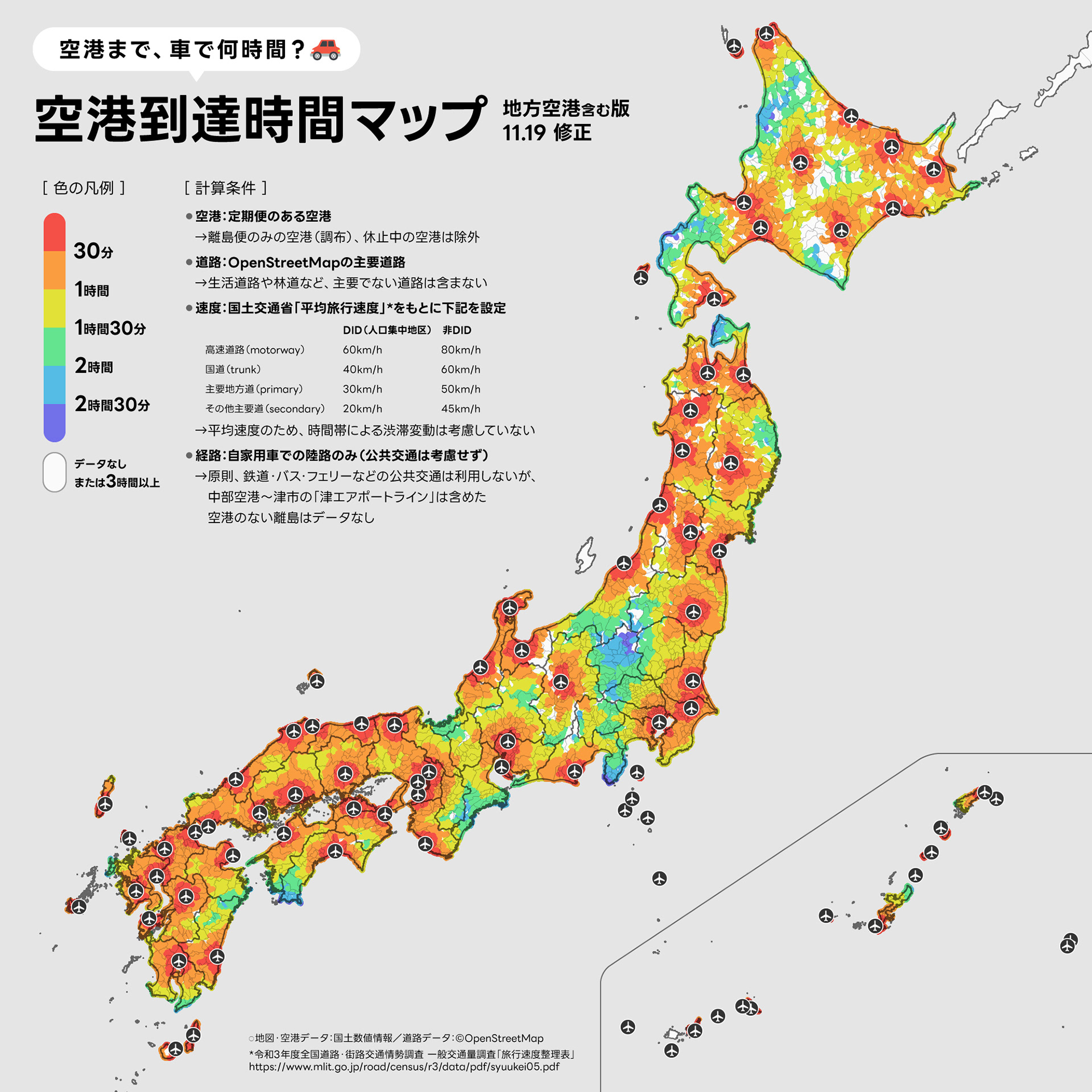
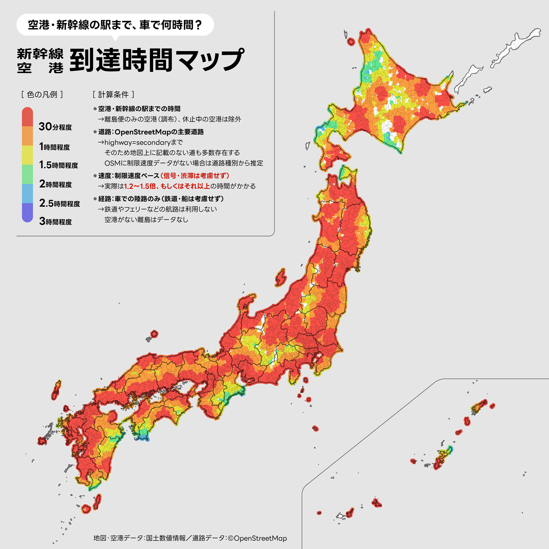
北海道に移住して「空港から最も遠い場所はどこだろう?」と疑問に思ったのがきっかけ。全国約100空港への車での到達時間をQGISで計算し、サーモグラフィー風の配色で可視化した。日本列島を15ブロックに分割して処理するなど、全国規模の到達圏解析に挑戦した作品。投稿後に「実際はもっと時間がかかる」という指摘を受け、国土交通省の平均旅行速度データを元に再計算した改善版も制作した。テレビ朝日「グッド!モーニング」で放送されたほか、ねとらぼ・まいどなニュースにも取り上げられた。詳しい解説はnoteに掲載。
After relocating to Hokkaido, I wondered: "Where is the most remote place from an airport in Japan?" Using QGIS, I calculated driving times to approximately 100 airports nationwide and visualized the results in a thermography-inspired color scheme. The sheer volume of road data required splitting the Japanese archipelago into 15 blocks for processing. After the initial post, feedback pointed out that real-world travel times are longer due to traffic and signals, so I created an improved version using the Ministry of Land, Infrastructure, Transport and Tourism's average travel speed data, which accounts for congestion. Featured on TV Asahi's Good Morning and covered by multiple online media outlets. Detailed write-up available on note.