
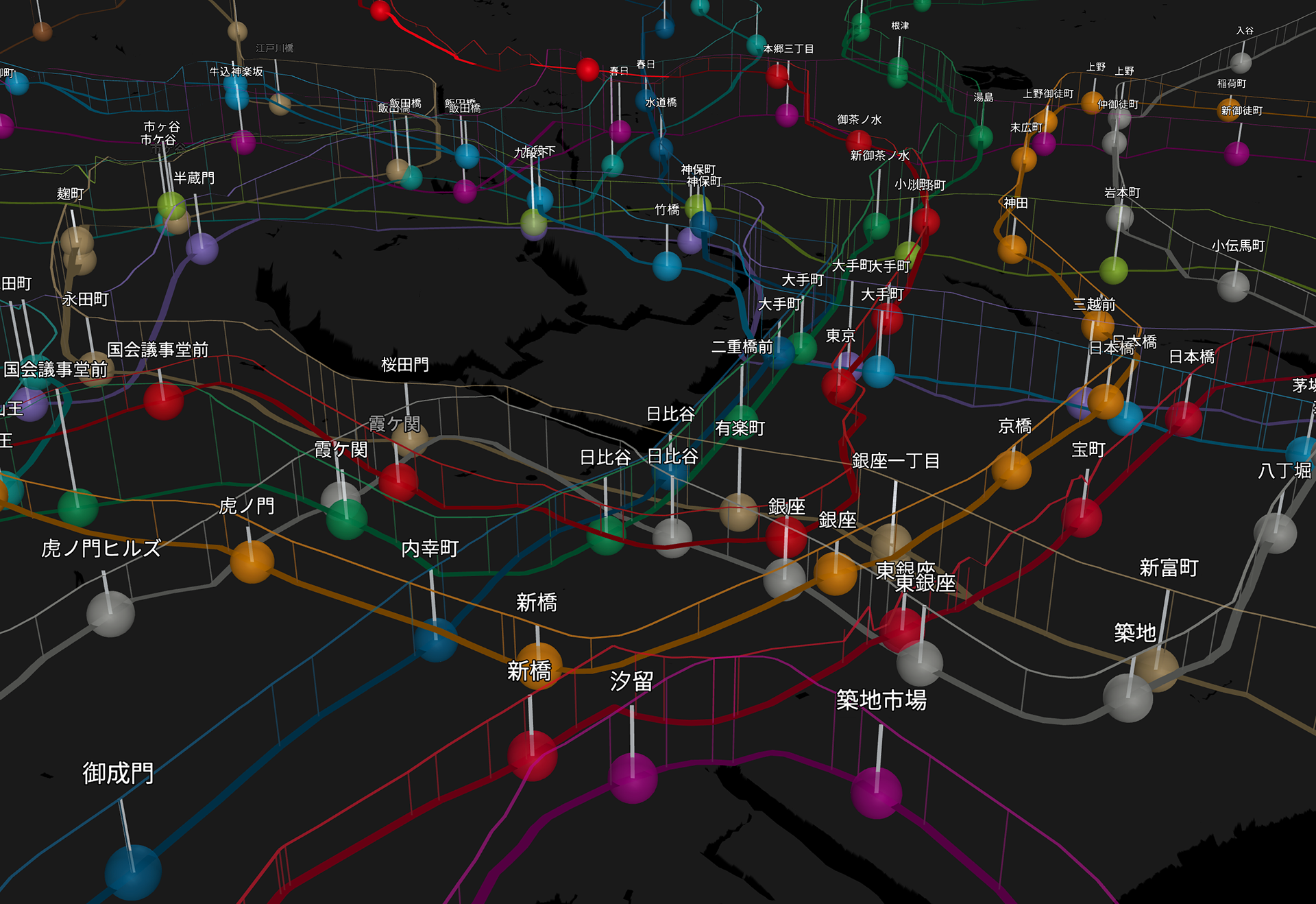
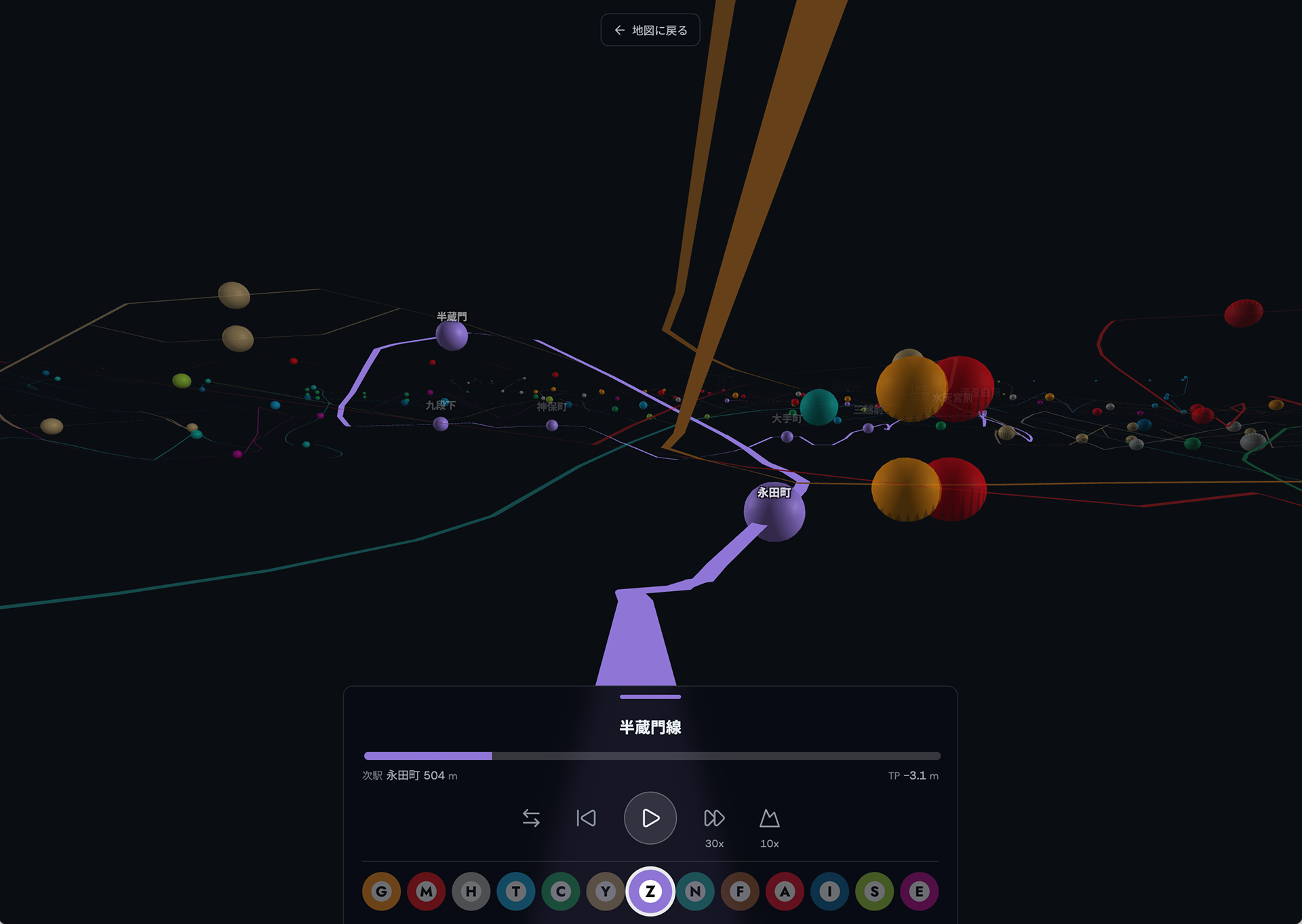
東京メトロ9路線・都営地下鉄4路線、合わせて13路線の地下構造を3Dで可視化したサイト。各駅の深さだけでなく、駅間の勾配まで含めた縦断面図データを、各路線の「建設史」や内閣府の資料から読み取って作成。T.P.(東京湾平均海面)を基準にした絶対標高で表示することで、地形と地下鉄の深さの関係まで正確に再現した。3Dマップ、断面図パネル、運転席視点で地下を走行できる「走行モード」の3つのモードを実装。Xで2.3万いいね超、Redditでも反響あり。詳しい解説はnoteに掲載。
A site visualizing the underground structure of Tokyo's 13 subway lines (9 Tokyo Metro lines and 4 Toei Subway lines) in 3D. The elevation profile data — not just station depths, but the gradient between stations — was digitized from each line's official construction history records and Cabinet Office documents. All elevations are shown relative to T.P. (Tokyo Peil, the Tokyo Bay mean sea level datum), accurately revealing the relationship between Tokyo's topography and subway depth. The site includes three modes: a 3D map, cross-section panels, and a "driving mode" offering a first-person view through the tunnels. Received over 23,000 likes on X and traction on Reddit. Full write-up on note.