
2018年5月
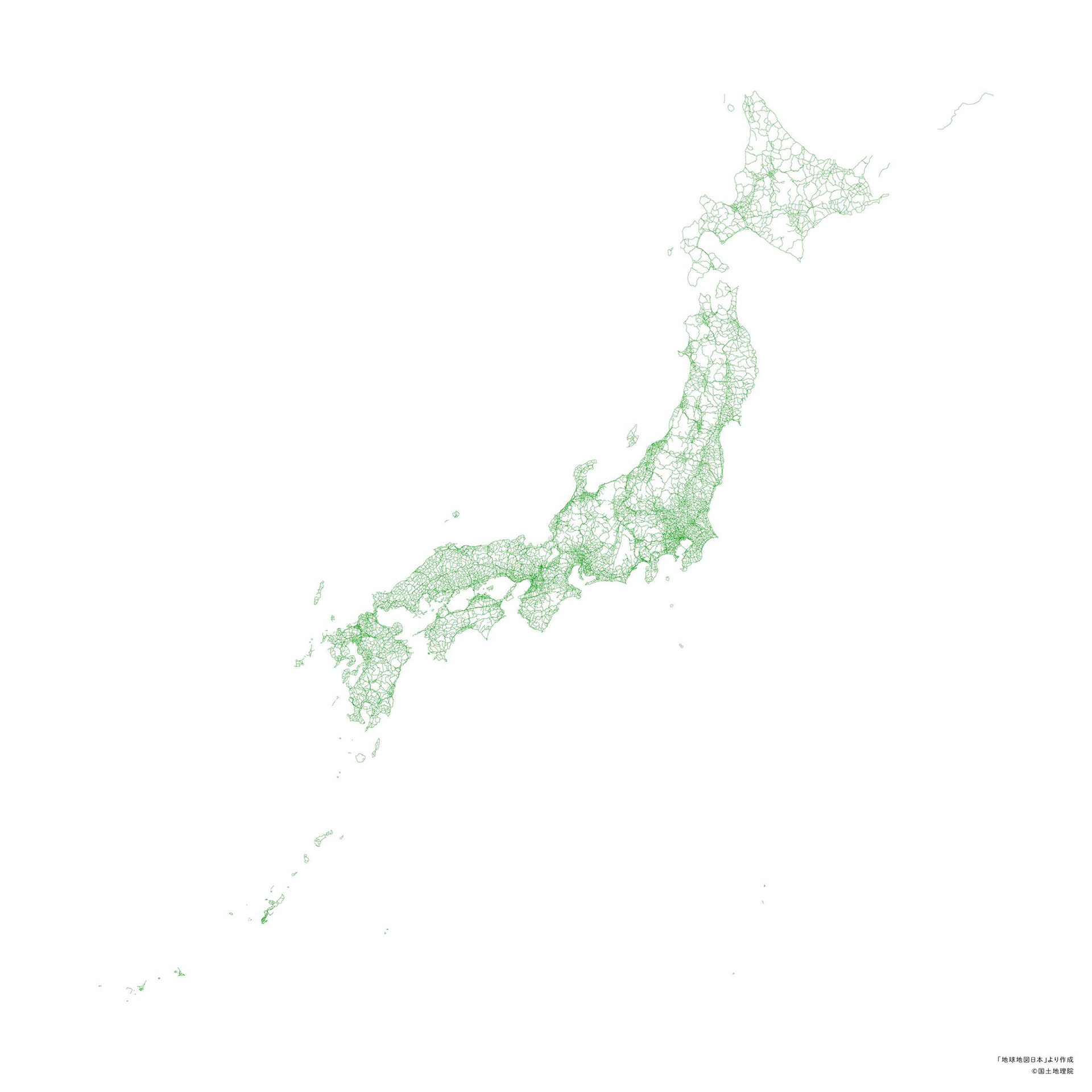
建物や鉄道、海岸線などの情報をすべて省き、道路だけで描いた日本地図。道路のネットワークだけで日本列島の形が浮かび上がってくる。脊梁山脈に沿って道路が粗になる東日本と、山間部にも道路が張り巡らされた西日本との対比も見えてくる。データは「地球地図日本」を使用。
A map of Japan drawn using only roads — no buildings, railways, or coastlines. The shape of the Japanese archipelago emerges from the road network alone. An interesting contrast is visible between eastern Japan, where roads thin out along the mountain spine, and western Japan, where roads are densely woven even through mountainous areas. Data sourced from "Global Map Japan."