
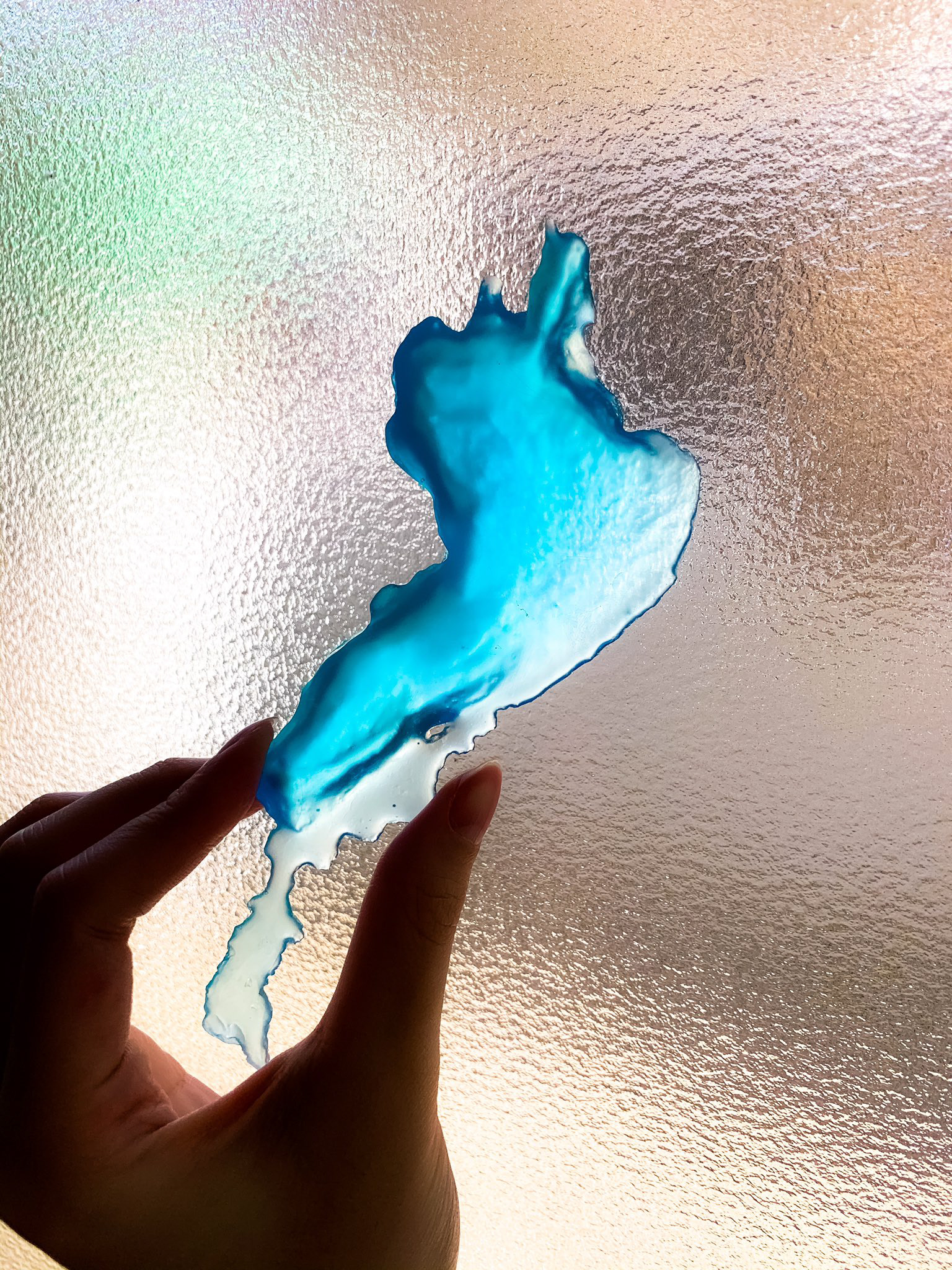
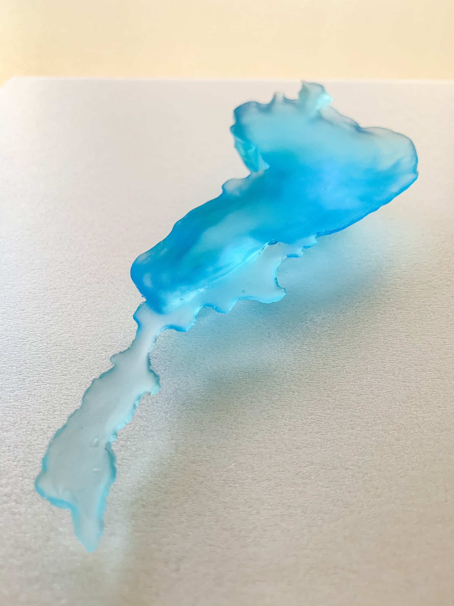
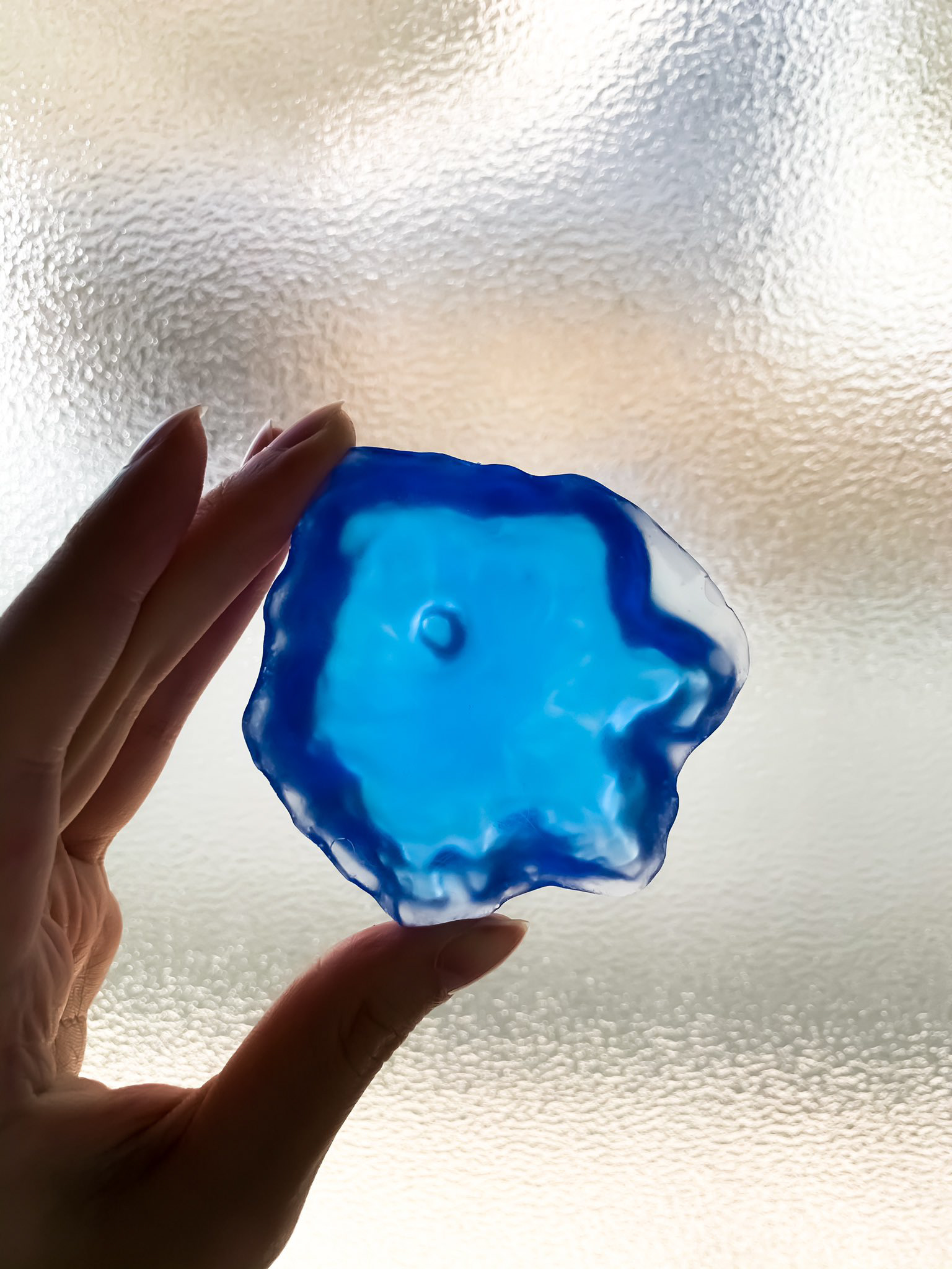
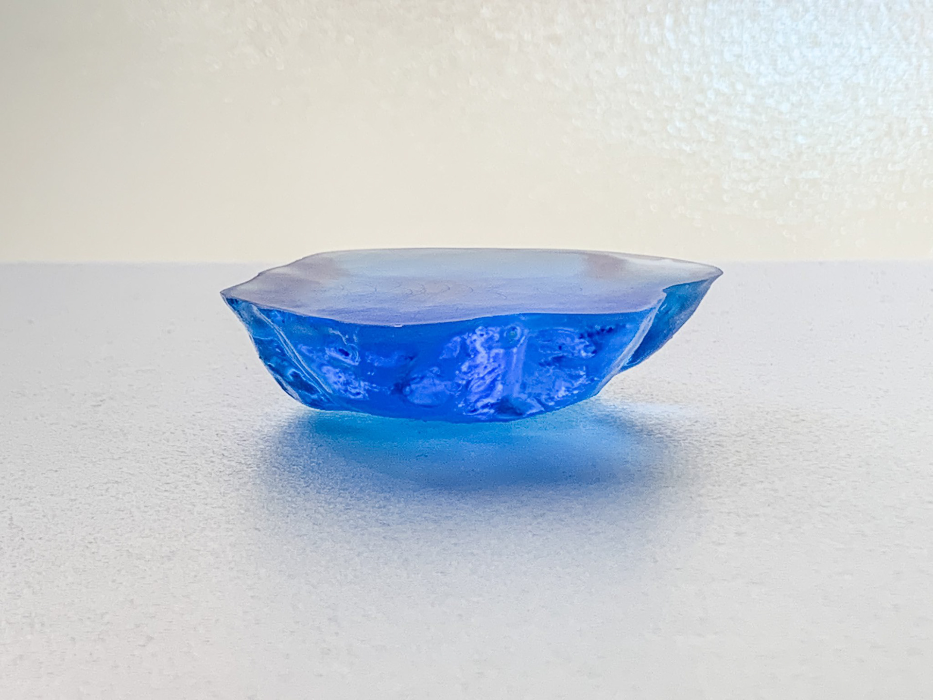
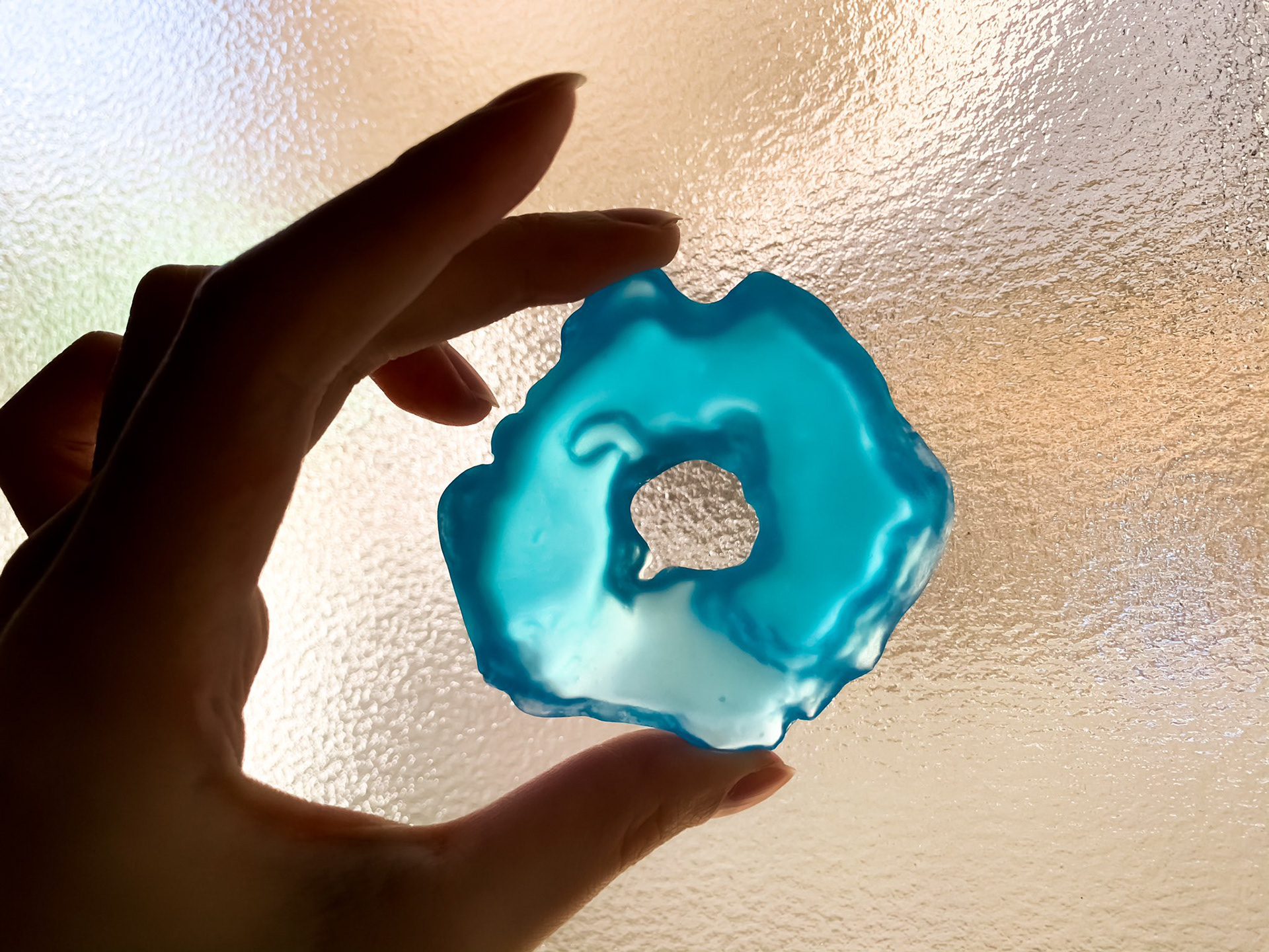
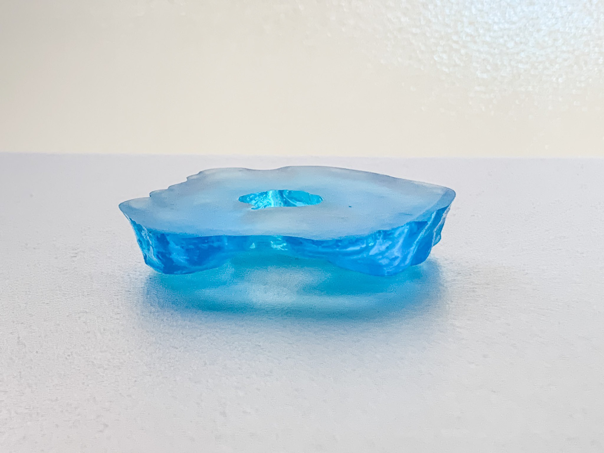
湖の水の部分をレジンで作った模型、琵琶湖・田沢湖・洞爺湖 / Resin model of the water part of the lake; Lake Biwa, Lake Tazawa, and Lake Toya
2020年12月
湖の水の部分をレジンで固めた立体模型。湖の地形(湖底)の立体模型は既にあるが、水の部分そのものにフォーカスした模型は見たことがなかった。そこで「水を固めたらどんな形になるか?」という発想から、琵琶湖(日本最大)、田沢湖(日本最深)、洞爺湖(中央に大きな島)の3湖を制作した。等深線をもとにスチレンボードを切り出し、段差を粘土で埋め、シリコンで型を取り、レジンを流し込むという工程で制作。
国土地理院の湖沼データをもとに作成。手作りのため地形は簡略化されており、高さも数十倍に強調している。
Physical resin models of Japanese lakes — capturing the shape of the water itself. While topographic models of lake beds already exist, no one had focused on the water volume as an object. "What shape would it take if you could solidify the water?" — with that idea, I created models of Lake Biwa (Japan's largest), Lake Tazawa (Japan's deepest), and Lake Tōya (featuring a large central island). The process involved cutting contour layers from styrene board, smoothing the steps with clay, making a silicone mold, and casting in resin. Data sourced from the Geospatial Information Authority of Japan's bathymetric charts. Due to the handmade process, the terrain is simplified, and the vertical scale is exaggerated several dozen times.