
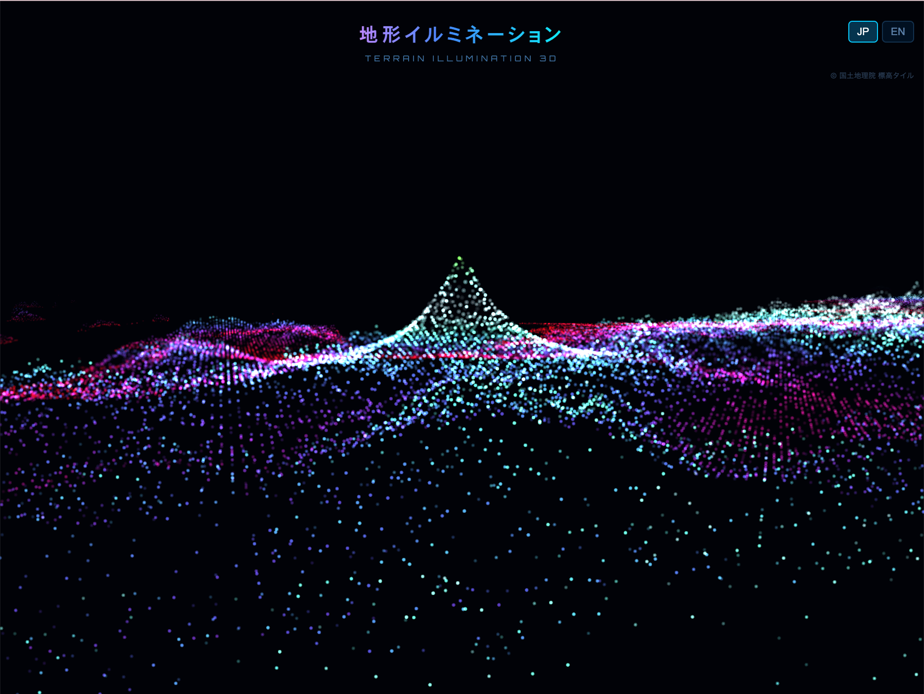
札幌・大通公園のイルミネーションを眺めていたとき、光の連なりが地形のように見えた——逆に地形をイルミネーションにしたらどうなるか?という発想から生まれた作品。国土地理院の標高タイルを使って日本の地形を3Dで描画し、色とりどりの光で彩るインタラクティブなWebアプリ。クリスマスカラーやサイバー風など複数の配色を切り替えられる。富士山や屋久島など、スポットを選んで楽しむこともできる。
While gazing at the illuminations in Sapporo's Odori Park, I noticed the lights resembled terrain — so what if terrain were turned into illumination instead? This interactive web app renders Japan's topography in 3D using elevation tile data from the Geospatial Information Authority of Japan, lit up with colorful illumination effects. Multiple color schemes are available, including Christmas, Cyber, and Sunset themes, and users can jump to specific spots like Mt. Fuji or Yakushima.