
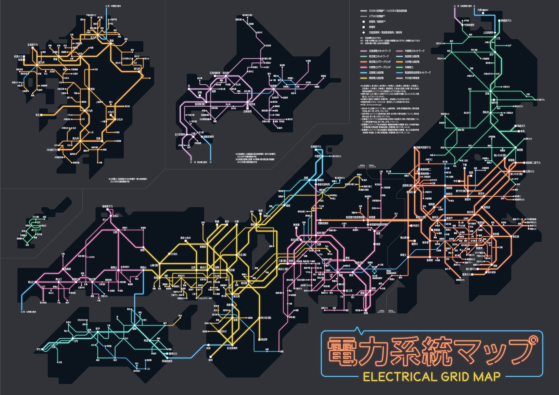
日本の電力系統の地図 / Japanese electrical grid map
日本全国の送電網(電力系統)を1枚の路線図スタイルのマップにまとめた作品。2018年の東京電力管内版を全国に拡大したもので、各電力会社がそれぞれ公開している系統情報を統合して作成した。完成までに約2年を要し、都市部に密集する送電線のバランス調整に苦労した。自分が使っている電気がどこからどうやって届いているのかが一目でわかるマップになっている。
Twitterで3.5万いいねの反響があり、エネ百科(日本原子力文化財団)のインタビュー記事にも取り上げられた。
A nationwide map of Japan's power transmission network, rendered in a transit map style. An expanded version of the 2018 Tokyo-area edition, this piece integrates publicly available grid information from all regional power companies across Japan. It took approximately two years to complete, with the biggest challenge being the visual balance between densely packed urban transmission lines and sparse rural areas. The map reveals where electricity comes from, how it reaches consumers, and the overall structure of Japan's power infrastructure. Received over 35,000 likes on Twitter and was featured in an interview article by the Japan Atomic Energy Relations Organization.