
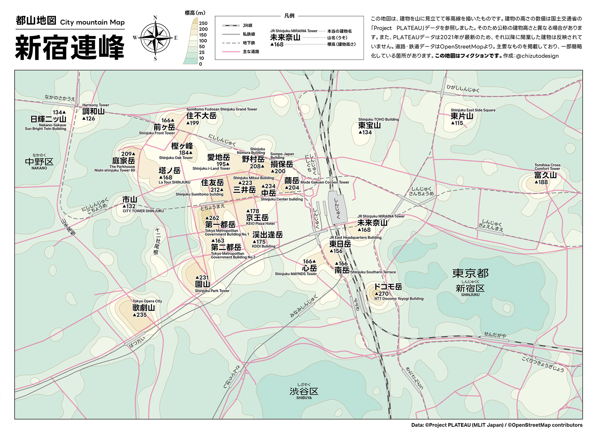
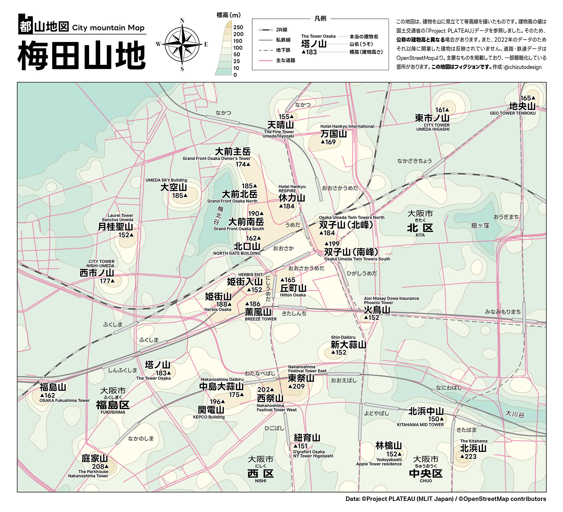
東京・新宿と大阪・梅田の高層ビル群の高さを山に見立て登山風地図にしました。/ Mountain-climbing style map depicting the skyscrapers of Tokyo's Shinjuku and Osaka's Umeda as mountains
2024年3月
Looking at clusters of skyscrapers in a city, I noticed they resembled mountain ridges — "cities have mountains too." This inspired me to reimagine the high-rise buildings of Tokyo's Shinjuku and Osaka's Umeda as actual mountains, depicted in the style of a hiking trail map. Building heights are treated as elevation, and building names are converted into mountain-style names — for example, the NTT Docomo Yoyogi Building becomes "Mt. Docomo." Featured on Togetter and Otakuma Keizai Shimbun.