
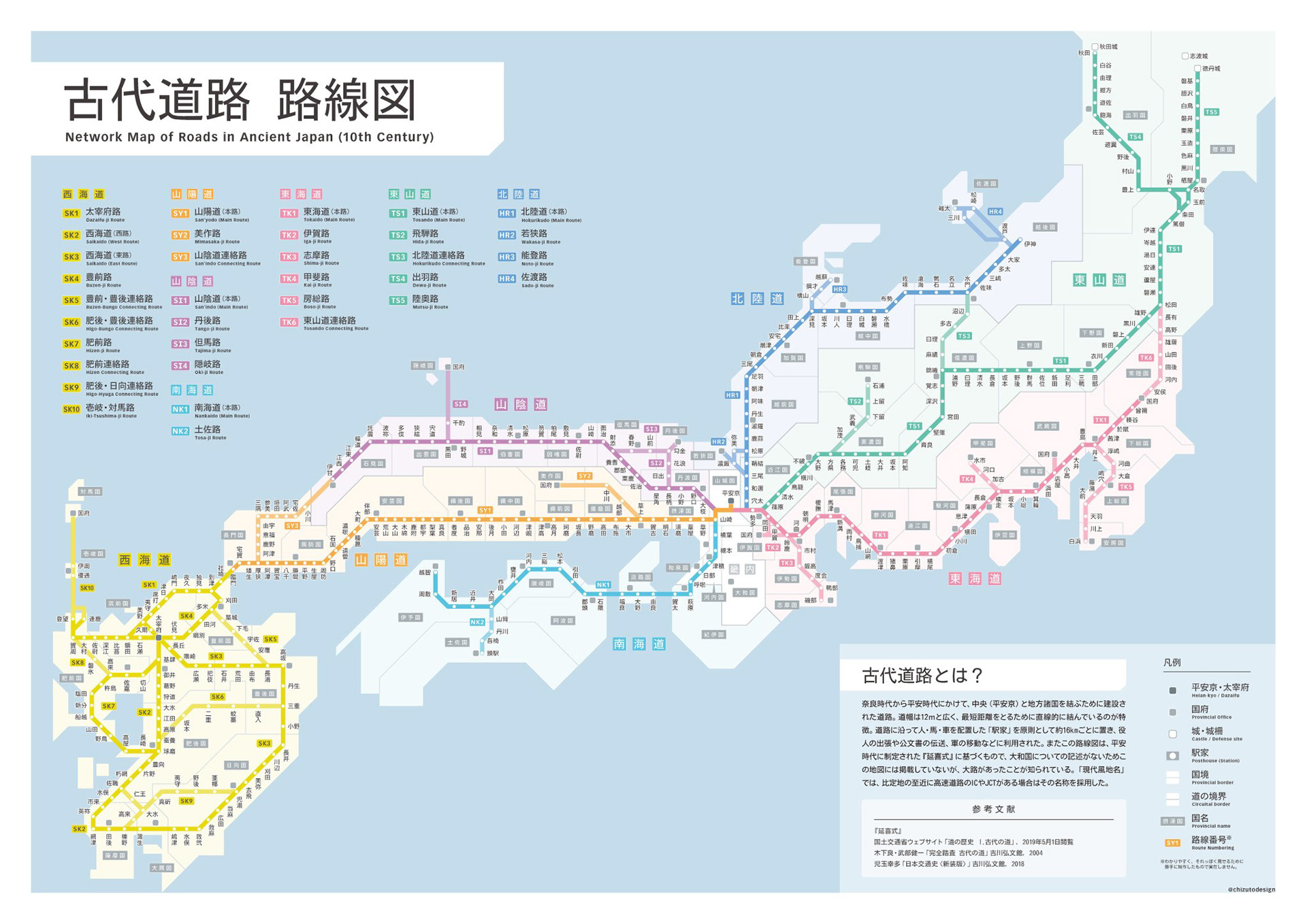
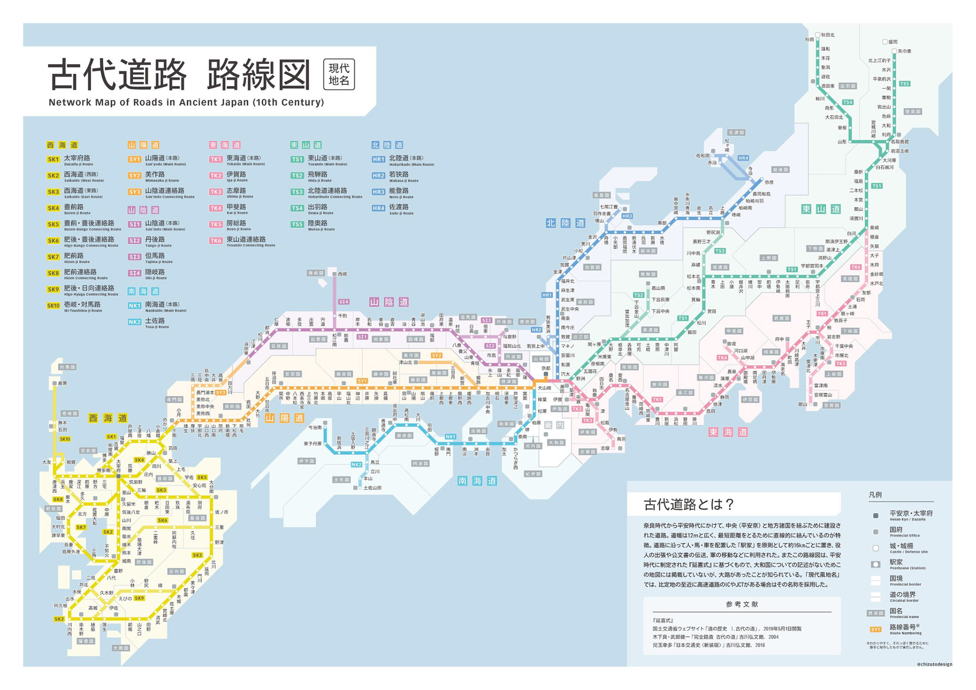
古代道路路線図 / Ancient road map
2019年5月
奈良時代から平安時代にかけて全国に建設された「古代道路」(古代官道)のネットワークを、現代の鉄道路線図スタイルで表現した作品。データは延喜式などをもとに作成。もっとも面白いのは、このネットワークが現代の高速道路網に驚くほど似ていること。1000年以上前に道幅10m以上のハイウェイが全国に張り巡らされていたというのは、それだけでロマンがある。現在の地名で高速道路のIC風の名称に置き換えたバージョンも作成した。
Japan's ancient highway network (kodai kandō), built from the Nara to Heian periods, depicted in a modern transit map style. Data compiled from the Engishiki and other historical sources. The most striking discovery is how closely this network resembles today's modern expressway system. The idea that highways over 10 meters wide spanned the entire country more than 1,000 years ago is fascinating in itself. A version with modern place names styled as expressway interchange names was also created.